
Current and updated as of March 2019 (Toll prices may vary)
This driving guide has been put together by Kevin Paulini from Ajijic Legal and Immigration services. Kevin has personally done this drive over 15 times and is part of the AccessLakeChapala.com team. Kevin is also our Immigration and Legal specialist. To contact Kevin, you can us our general contact button on the navigation bar above and we will forward your message on to him.
Driving Guide From Laredo Texas to Chapala Mexico
 There are a few different variations for driving to Laredo, Texas from Ajijic, Jalisco. I have personally made this trip more than 40 times, and have found the instructions below to be the best way in my opinion. In fact, new Garmin GPS systems follow this route as well. There are very good roads with bypasses around almost all towns, making it a smooth and effortless 11 to 12 hour drive. This time is keeping to reasonable speeds.
Make sure you have pesos for this trip, we have not encountered any fuel station that takes dollars and certainly no tolls will. The toll costs listed below are from November, 2018 and can change at any time.
 You may or may not find Military and or Federal Police check points. My last particular drive in mid – November 2018 found 3 which just flagged us through. Back in March I ran into 2, just be aware they could be out there, stop if asked, remove your sunglasses and have papers ready just in case they ask.
Most of these roads are good but do vary in surfaces for no reason. Always be alert because some of the curves and hills can catch you by surprise. Make sure all fluids including coolant are good, and tire pressures are very important as well.
Gas stations are plenty on this route, as well as some convenience stores like OXXO to get snacks and drinks. There are also a few Subway restaurants along the way too if the local cuisine is not to your liking.
 The mileage listed is from my SUV odometer, and should be accurate, but I am sure some others may have discrepancies to mine. So make sure you are ready for the upcoming directions a head of time. The mileage listed is miles.
Most of all, have fun, this is a beautiful drive with some incredible scenery.
The start of this drive to Ajijic starts when you take the bypass around Nuevo Laredo and meet highway 85 to Monterrey.
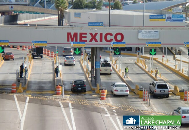
At the end of the I-35, there are a few traffic lights and then you enter the border area. Here your vehicle will be photographed by the US as you are leaving, then you will pay the $4 USD toll to cross the international bridge into Mexico.
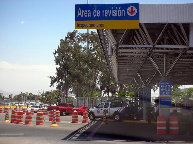
At the end of the bridge is all brand new. You will come to the “Red Light” “Green Light” which either you get stopped and checked by customs or you continue into Mexico. Once you are past these lights you will turn left and follow that road for about half a mile to a traffic light, which is the bypass around Nuevo Laredo.
 *If you need to visit with Immigration or get a Temporary Importation Permit for your car, turn left at this light and follow the road back down under the bridge to the building on the left (right is the river). Inside that large building is where you will find Immigration and the car permit people. Once you are done there, return up the road to the traffic light and go left onto that road around Nuevo Laredo.
*If you do not need Immigration or the Car Permit office, merge right and follow the bypass around to the highway south to Monterrey.
Follow that around until you get to the highway to Monterrey. Cross under the highway and turn left.
TO DOWNLOAD THESE INSTRUCTIONS IN MILES CLICK HERE
TO DOWNLOAD THESE INSTRUCTIONS IN KILOMETERS CLICK HERE
This is where I reset my trip odometer to 0.0.
0.0 Highway overpass. Here you will turn left and start heading south on HWY 85. This road is a little on the rough side, so take it easy.
10.8 Customs and Immigration check point. This check point has been closed for some time now and is actually being torn down. It is manned my Immigration, but they almost always wave you through. Have papers handy just in case.
42.9 Merge left to the Cuota road to Monterrey.
117.3 You will be passing through a small town here with an airport on the right and several Pemex stations on the left.
119.0 Turn right towards Saltillo, This is the bypass around Monterrey.
133.2 Toll $155 pesos
142.7 Keep right for the Cuota road to Saltillo
143.3 Toll 65 pesos
160.7 Exit right to 57 which will curl down to the free road to Saltillo. Always watch for Matehuala.
163.6 Keep left and exit to Matehuala on 57D. This overpass to the left is really rough, keep speed down. This is the bypass around Saltillo
170.9 Toll $40 pesos
198.2 Toll $62 pesos
244.8 Federal Police Inspection
310.1 Sign welcoming you to the State of San Luis Potosi
319.0 Start of bypass around Matehuala – Matehuala is the mid-way point at around 6 hours. Good place to stay if you do not wish to make the drive in one shot, this town pretty much divides the trip in half. There great hotel called Las Palmas in town. Also good food is to be had here. Las Palmas also has secure RV parking. If you choose this option just be careful of the mileage as it will vary from simply going around, but it shouldn’t be much.
322.1 Toll $26 pesos
328.3 Rejoin main highway through Matehuala
374.4 Keep left following signs to San Luis Potosi
409.2 First sign for Guadalajara
425.5 By pass around San Luis Potosi (SLP), toll road to the right
431.7 Zacetecas – Guadalajara toll road to the right
439.2 Toll $68 pesos
447.2 Stay straight to Guadalajara
447.6 Stay to the right for Guadalajara
452.0 Toll $51 pesos
462.5 Stay straight to Guadalajara
482.5 Stay straight to Lagos de Moreno HWY 80
519.5 Toll $107 pesos
531.7 Turn right around Lagos de Moreno
535.9 Straight through to Guadalajara
539.4 Turn right to Guadalajara
557.4 Keep right to toll road to Guadalajara
563.0 Keep straight to Guadalajara
575.2 Toll $167 pesos
605.2 Toll $202 pesos
629.9 Keep straight to Chapala
633.1 Toll $55 pesos – Last one
647.7 Exit for Guadalajara and Chapala
649.3 Take the left hand returno to go south to Chapala
659.1 Exit right to Ajijic
662.7 Arrive at traffic light in Ajijic (across from Walmart)
Welcome Home!
To read our driving guide back up North from Lake Chapala to Laredo click here
By, Kevin Paulini